Category Islands

What kind of country is Kiribati?

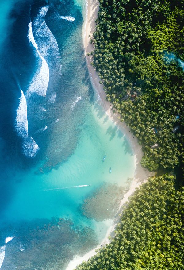
Kiribati, an island chain in the Pacific Ocean, is the only country in the world that is situated within all four hemispheres of the globe.

Despite having a population of 120,000 and a land mass of 811 squared kilometres, there is almost 4000 kilometres between the easternmost and westernmost parts of Kiribati – which is almost as wide as Australia.

At its highest point, Kiribati stands at a mere height of just eight metres above sea level. Once combined, the 33 stunning, paradisiac islands and atolls make Kiribati the only country in the world to cross all four hemispheres.

With such remoteness comes great challenges. However, since becoming a member association in 2010, the federation have made encouraging progress in their effort to bring badminton to a small nation.

Leading the charge for badminton is Kiribati’s Shuttle Time Co-ordinator Tongoboo Beero, who first came across Shuttle Time in 2012 as a participant. Since then, Tongoboo has powered through the ranks.

In 2019, he was one of 10 trained Shuttle Time teachers who inspired over 600 participants into getting fit and active within their communities with badminton. Earlier this year, he was part of a leadership team who delivered teacher training to expand Kiribati’s Shuttle Time teacher pool. His combined efforts earned his a space in the BWF’s Humans of Shuttle Time campaign.

Moreover, other teachers from Kiribati have noticed a significant rise in popularity. Taonibeia Mwakuti has delivered to more than 50 kids in her local community, which has made a big difference to their lives where there are only a limited number of other activities to keep them engaged.

“We both enjoy the game and can say that we have improved a lot especially with our grips and serving technique” say Mwakuti’s students, Biritia Peter and Eimwa Obwaia.

The complex logistics involved in sending and receiving badminton equipment is one issue for the remote nation. However, finding a suitable badminton court to play on is another.

To combat the lacking badminton facilities, many of the Pacific Islands play outdoors. However, Shuttle Time teachers and students came together recently to paint the lines of a badminton court under a shelter to give a better understanding of the game.

Credit : Badminton Oceania

Picture Credit : Google

Quis Lipsum Suspendisse Ultrices Gravida Dictum Fusce

Risus quis varius quam quisque id diam vel. Scelerisque viverra mauris in aliquam sem fringilla ut morbi tincidunt. Quis varius quam quisque id diam. Quis ipsum suspendisse ultrices gravida dictum fusce. Tellus in metus vulputate eu scelerisque felis imperdiet proin. Cras semper auctor neque vitae tempus quam pellentesque.

Vel fringilla est ullamcorper eget nulla facilisi etiam dignissim. Ac odio tempor orci dapibus ultrices in. Enim nulla aliquet porttitor lacus luctus. Eget lorem dolor sed viverra ipsum. Risus commodo viverra maecenas accumsan lacus vel facilisis volutpat est. Odio ut sem nulla pharetra diam sit amet nisl. Quam quisque id diam vel quam elementum pulvinar etiam.

Senectus et netus et malesuada fames ac turpis egestas. Sed libero enim sed faucibus turpis in eu. Pharetra diam sit amet nisl suscipit adipiscing bibendum est. Leo in vitae turpis massa sed elementum tempus egestas. Vulputate dignissim suspendisse in est ante in nibh mauris cursus. Nulla pellentesque dignissim enim sit amet. Eleifend mi in nulla posuere.

Morbi tristique senectus et netus. Est pellentesque elit ullamcorper dignissim cras. Scelerisque mauris pellentesque pulvinar pellentesque. Nisl purus in mollis nunc sed. Quam vulputate dignissim suspendisse in. Tellus in metus vulputate eu scelerisque felis imperdiet proin fermentum.

Pharetra diam sit amet nisl suscipit adipiscing bibendum est. Leo in vitae turpis massa sed elementum tempus egestas. Vulputate dignissim suspendisse in est ante in nibh mauris cursus. Nulla pellentesque dignissim enim sit amet. Eleifend mi in nulla posuere.

Pretium Lectus Quam Lidleo Unvitae Turpis Commodo Odio Aenean

Egestas pretium aenean pharetra magna ac placerat. Amet cursus sit amet dictum. Viverra justo nec ultrices dui sapien eget mi proin sed. Faucibus interdum posuere lorem ipsum dolor sit amet consectetur. Sit amet risus nullam eget felis eget. Tristique senectus et netus et malesuada fames. Non curabitur gravida arcu ac. Nulla pellentesque dignissim enim sit amet venenatis urna cursus. Mi eget mauris pharetra et ultrices neque ornare aenean euismod. Id neque aliquam vestibulum morbi blandit cursus.

Varius morbi enim nunc faucibus a pellentesque sit amet porttitor. Amet justo donec enim diam vulputate ut pharetra. Morbi tincidunt ornare massa eget. Pretium lectus quam id leo in vitae turpis. Mauris ultrices eros in cursus turpis massa. Massa tincidunt nunc pulvinar sapien et. Vulputate mi sit amet mauris commodo quis imperdiet. Volutpat consequat mauris nunc congue nisi. Ut porttitor leo a diam sollicitudin. Risus nullam eget felis eget nunc lobortis. Aliquet bibendum enim facilisis gravida neque convallis a cras semper.

Semper risus in hendrerit gravida rutrum quisque non. Quis commodo odio aenean sed adipiscing diam donec adipiscing. Lacus suspendisse faucibus interdum posuere lorem ipsum dolor. Vitae suscipit tellus mauris a. Quis enim lobortis scelerisque fermentum dui faucibus. Duis at tellus at urna. Pellentesque eu tincidunt tortor aliquam nulla facilisi. Pulvinar sapien et ligula ullamcorper malesuada proin libero nunc consequat. Orci ac auctor augue mauris augue neque gravida.

Where is surtsey?

            Surtsey is a volcanic island a few miles south-west of the West man Islands which are situated off the south coast of Iceland. The island appeared as a result of a volcanic activity on November 15, 1963. The Icelanders took the infant island into their care because it appeared in their territorial  waters.

            They called the volcanic vent Surtur, and the island Surtsey (island of Surtur): In Old Icelandic mythology Surtur was a giant who brought destructive fire from the south as a weapon in his fight with Frey, the god of fertility.

            During its early life there was doubt about the island’s chance of survival, and many thought it might disappear. A similar one did vanish in 1783 after erupting from sea 65 miles south-west of Reykjavik, the Icelandic capital. Survival and long life were assured when re­peated outpourings of thin flowing lava followed the first violent eruptions. The lava capped the volcano with a gently sloping regular dome which acted as a protective shield.

            The arrival of Surtsey was no real surprise. For the 10,000-mile Mid-Atlantic Ridge, of which Ice­land forms the largest above-sea land mass, had been active along its length for some years up to 1963, although since then things seem to have settled down, al­though further activity is always possible. The neighbouring West man Islands were produced by volcanic activity 8,000 years ago.

Picture credit: google

What is the Heligoland bight?

        The Heligoland Bight is an arm of the North Sea extending south and east of the red sandstone island of Heligoland. Heligoland is a small remote island of the German north Frisian group lying in the North Sea between the coast of Schleswig-Holstein and the estuaries of the Jade, Weser and Elbe. It is 5,249 feet long and 1,640 feet wide at its broadest point.

          In 1807 Heligoland was a Danish possession but it was seized by the English in 1814 and given to Germany in 1890. Before 1914 Germany developed it as a great naval base with an extensive harbor in the south-east. There was a network of underground fortifications and coastal batteries and it was known as the “Gibraltar of the north Sea”. The Heligoland Bight became famous as the scene of a naval battle between the British and the Germans on August 28th, 1914.

Heligoland became a strong hold again under the Nazis and the capital town of Heligoland was destroyed by Allied bombers. In 1947 the whole character of the island was changed by the destruction of the fortifications.

Picture credit: google

Where is the Gulf Stream?

          The Gulf Stream is in the Atlantic. It is a warm ocean current which flows steadily from the Gulf of Mexico north-eastwards. One branch reaches the Canary Islands, turns southwards and moves back across the south Atlantic. The other branch flows past the western coasts of northern Europe.

           This current, which is like a river in the sea, is 50 miles wide at its narrowest and nearly 2,000 feet deep. It sweeps along with it many forms of warm water life from the tropics, but these die before they reach the European coasts where the warm water mixes with cold water moving down from the Arctic.

      The Gulf Stream has a great effect on the weather of Britain and Norway. The prevailing south-westerly winds are warmed by it and collect moisture which turns into rain. In winter the warm water keeps open the cold northern ports, such as Hammerfest, in Norway, and Murmansk, in the Soviet Union, while harbours in the Baltic, many miles farther south, are blocked with ice. In summer it causes bright flowers to bloom on the West coast of Spitzbergen 500 miles north of Norway. In contrast, the east coast, cooled by arctic water, is bleak and colorless.

       In 1912 the United States congress was asked for money to build a jetty which, it was thought, would divert the Gulf Stream and make it flow up the east coast of the United States. Although this scheme was unlikely to be successful, it was just as well for Britain and Norway that it was never tried. Without the Gulf Stream, Britain’s winters would be very much longer and colder, and Norway’s harbours, which are vital to the country, would be frozen over for many months.

What makes the Mamanuca Islands a place to see?

           The Mamanuca Islands are a group of volcanic islands in Fiji that lie to the west of Nadi and south of the Yasawa Islands. Altogether the archipelago consists of 20 beautiful islands out of which only a few are inhabited.

          What makes the Mamanuca Island cluster a popular tourist destination is its coastal beauty. The sandy beaches, live coral reefs, and the crystal clear water together offer an amazing experience to the visitors of this serene archipelago.

          In addition, one can also engage in activities like swimming, diving, surfing and snorkelling in the waters here.

          The Namotu Island noted for luxury resorts, the Plantation Island or Malolo Lailai that offer water sports and the Castaway Island, or Qalito are some of the major tourist sites in Mamanuca.


What makes Faroe Island a tourist attraction?

          Faroe Islands is a cluster of beautiful islands in the North Atlantic Ocean that lie between Iceland and Norway. It is a self-governing administrative division of Denmark. As many as 17 inhabited islands are part of this cluster, along with many islets and reefs.

          The Faroe Islands are said to be high and rugged due to their volcanic composition.

          The islands are largely treeless and the natural vegetation consists of moss, grass, and wetland. It also lacks indigenous mammals, reptiles and toads but is home to rats and hares. There are as well numerous sea birds on the island.

          The Faroese people are said to be mostly descendants of Norwegian Vikings who colonized the place in AD 800. Many of them depend on sheep rising for their livelihood. But the economy of the island primarily focuses on fishing and related industries. Faroese and Danish are the two official languages on the island. The former had a rich oral literature that was not written down until the 19th century.

Why is Lamu Island considered as a must visit place?

          One of the most attractive places in Africa, the Lamu Island, is a part of the Lamu Archipelago of Kenya. The island stands out for its beauty.

          Geographically, the island is composed of a town and three villages – Shela, Matondoni and Kipungani. When one reaches the land, one cannot wait for a taxi or any other motor vehicle, simply because there aren’t any on the island! Yes, that is one of the major features of Lamu that people use only non-motor modes of transportation like donkeys, bicycles etc.

          The most important part of the island is the Lamu Old Town, which was once a major trading centre in coastal East Africa. It is also a historically important centre of Swahili culture, as well as religion.

          Some of the historic sites here include the German Post Office and the Lamu Fort. Another sight that stirs wonder in the mind of any traveller is the use of coral stone and mangrove timber throughout the island, which is a Swahili feature.


Who discovered Australia?

          Australia is the smallest continent but the largest island (piece of land covered with water from all sides) of the world. Its total area is about 8,000,000 sq. km (3,000,000 sq. miles). People during the medieval times talked about the existence of a large continent in the Southern Hemisphere. No one had seen it and people wondered what it was like and whether it was inhabited at all. It was called the ‘unknown southern land’.

          During the 16th century, European countries had been seeking new lands in order to expand their commercial activities. In 1606 the Dutch were the first to visit Australia. Their ship called the ‘Dnyffkin’ anchored off the Northern coast of Australia. When some of its crew went ashore to refill their water casks, they were driven out by the fierce natives. The Dnyffkin sailed away without exploring any other part of the vast continent.

          In 1642 Captain Abel Tasman was sent by the Dutch to explore more about the continent. He sighted the west coast, which he called Van Diemen’s Land (Tasmania). Later he explored New Zealand. In 1770 the English Captain James Cook discovered the South Eastern coast of Australia and named it New South Wales. In 1788 the first English colony was established in the city of Sydney.

          Who, then, were the first inhabitants of Australia?

          Before the arrival of Europeans in the late 18th century the country was first inhabited by the Aborigines who reached Australia from Southern Asia about 20,000 years ago. In 1870 there were about 300,000 Aborigines in Australia. They arrived in two groups; the first group was eventually driven from the south-east into Tasmania; the second was racially quite different which occupied the rest of Australia.

          Today, Australia is among the highly developed countries of the world. Its inhabitants are self-sufficient in almost every respect. It has many distinctive features. Two-third of its land is a desert. It is, however, rich in minerals like gold, tungsten, manganese, cobalt, lead and zinc. Its unique wild life includes animals like kangaroo, koala and birds like emu, black swan. The plants like giant eucalyptus and bottle tree are found here in abundance.


What makes Singapore unique?

Singapore is the world’s only island city state. It consists of 63 islands that together form a global city, and a sovereign state.

 The island nation of the Republic of Singapore lies one degree north of the Equator in Southern Asia. Singapore was founded by Sir Stamford Raffles in 1819 as a trading post of the British East India Company.

 After the company collapsed, the British Government took over. Singapore became independent in 1963. Though physically small, Singapore is an economic giant. It has been Southeast Asia’s most modern city for over a century.

Singapore existed even before the founding of the trading post. According to local history, it was founded in 1324 by Sang Nila Utama, a Srivijayan prince from Palembang, or present day Indonesia.

 While hunting in the island of Temasek, he saw a strange animal with an orange body and black head. He was told that it probably was a lion. Believing it to be a good omen, he founded the city, and named it Singapura, which means Lion City.


Why are the Philippines an interesting island nation?

  The Philippines is an island nation in South East Asia. It lies in the Pacific Ocean, near the equator, and is made up of around 7641 islands. The Philippines are a part of the Pacific Ring of Fire, which means it has many active volcanoes. It is also prone to earthquakes and typhoons.

At the same time, these islands are blessed with abundant natural resources. There are beautiful beaches and coastal areas, as well as towering mountains and lush valleys.

The Philippines has a rich and varied wildlife, and the highest rate of discovery of new animal species. Sixteen new species of mammals have been discovered just in the last 10 years.

 Interestingly, there are between 120 and 175 individual languages spoken in the Philippines, 171 of which are living, while the other four no longer have any known speakers. 

What is the significance of the Andaman and Nicobar Islands?

The Andaman and Nicobar Islands are two groups of islands located at the meeting point of the Bay of Bengal and the Andaman Sea. These islands form one of the seven union territories of India. The Andamans, consisting of some 300 islands, were the site of a British penal colony from 1858 to 1945.

This was the famous Cellular Jail where many of India’s freedom fighters were imprisoned. The Nicobars, which comprise 19 small islands, are separated from the Andamans by a channel.

 Since World War II and Indian independence, some of the islands have undergone significant population growth and economic development.

There are Indian military bases here, and regular air and ship services connect the islands with the mainland. The islands are crucial for controlling India’s interests in South East Asia, because of their strategic location. 


How did Lakshadweep get its name?

The Lakshadweep is an archipelago of islands that lie in the Arabian Sea, off the coast of Kerala. The archipelago forms the smallest among the union territories of India.

            These islands get their name from the Sanskrit word ‘lakshadweepa’ which means ‘one hundred thousand islands’. The 36 main islands in this archipelago have only 32 square kilometres of land between them. Most of the other islands in Lakshadweep are very small, and not inhabited.

The islands were once part of the Chola Empire. Later, the Portuguese, and then the British, took control. When India won independence from the British, Lakshadweep became a part of India. Coconut production and coconut fibre extraction are two most important industries in Lakshadweep.


What is the tactical importance of Sriharikota Island?

 Sriharikota is a barrier island. It lies in the Bay of Bengal, off the coast of Andhra Pradesh. Sriharikota is of tactical importance to India, as it is an ideal launch site for geostationary satellites.

 Its location is remote enough to ensure that human beings are not exposed to any danger in the case of an accident, yet accessible enough by land, air and water to transport huge machinery and equipment without any problems.

 The climate too, is suitable. Heavy rains come only in October and November, so outdoor testing is possible for the remaining ten months of the year.

            For these reasons, Sriharikota houses the Satish Dhawan Space Centre, one of the two satellite launch centres in India. The other is the Thumba Equatorial Rocket Launching Station in Thiruvananthapuram.


Why is Willingdon Island special?

Willingdon Island, which is part of the city of Kochi in Kerala, is the largest man-made island in India. The island was created from the sand dug out while deepening Kochi port. It was built around a previously existing but tiny Natural Island.

Willingdon Island was named after 1st Earl of Willingdon, the Viceroy of India at the time, who was instrumental in implementing this island project. The main engineer who spearheaded this project, however, was Robert Bristow.

Willingdon Island is surrounded by beautiful backwaters. It is the site of the city’s best hotels and trading centres, the Port Trust, and the headquarters of the southern naval command.

 During its short colonial tenure, Willingdon Island handled almost one million tonnes of freight, and by the year 1960, the traffic had almost doubled. It is a major artificial port in India, and serves as an important landmark of Kochi.

 Willingdon Island serves as a link between the city, and some other seaports of the world.


What are the attractions of Bhavani Island?

Bhavani Island is located in the midst of the River Krishna at Vijayawada.

Spread over 58 hectares, it is one of the largest among river islands in India. The island possesses one of the biggest lagoons in the region.

One of its attractions is its nearness to the Prakasam Barrage, which stretches 1223.5 metres across the River Krishna, linking Krishna and Guntur Districts. The Prakasam Barrage is remarkable, and is comparable to the city of Venice with its three canals running through the city of Vijayawada.

 The Kanaka Durga temple to which pilgrims flock, is another attraction. Bhavani Island is also a popular picnic spot due to its serene beauty, and the facilities for boat rides and swimming pools.

Why is Pamban Island or Rameswaram Island a prominent one in India?

Pamban Island, also known as Rameswaram Island, is an island located between India and Sri Lanka. The island is famous for Rameswaram, which is a pilgrimage destination.

 Pamban Island is comparatively big in size. It extends from the township of Pamban to the remains of Dhanushkodi. Rameswaram is the largest and most populous town on the island. It is one of the most sacred religious sites.

 At the eastern tip of the island lies the site of Dhanushkodi, a harbour and a pilgrimage centre, which was washed away by the December 1964 cyclone. Prior to its destruction, it was a flourishing township and a prominent place of pilgrimage. 


Why Divar Island is considered a charming place?

 Divar Island lies in the Mandovi River about 10 kilometres upriver from the capital of Goa, Panjim. The name Divar has evolved from the word ‘dipavati’ which means ‘Small Island’ in Konkani. This beautiful little island is a serene and seldom visited place that retains the old world charm of rural Goa.

In fact, most of its inhabitants once lived in Old Goa, but fled to the island to escape from a terrible plague that was sweeping across the mainland. The largest settlement on the island is a picturesque village called Piedade.

 Divar was the site of two important temples — the Sapta-koteshwara Temple, as well as a Ganesh temple that stood on the solitary hill in Piedade. These temples were later destroyed.

 Today, Divar is well known for its beautiful church, the Church of Our Lady of Compassion.

The world famous Bonderam festival is celebrated in Divar, during the monsoon with great fanfare. The festival was attended by thousands of tourists and locals.


Why is Elephanta Island fascinating?

Elephanta Island lies east of the city of Mumbai in Maharashtra. It is also known as Gharapuri, which means ‘place of caves.’ Elephanta Island is indeed famous for its caves. These caves have been carved out of rock, and the rock-cut temple complex covers an area of 5574 square metres. It consists of a main chamber, two lateral chambers, courtyards, and subsidiary shrines.

 It is believed that the caves were carved between 400 and 800 AD. The statues depict stories of Lord Shiva. The most important sculpture inside the Elephanta Caves is that of Trimurti Sadasiva. Other sculptures depict Lord Shiva in the dancing pose, the yogic pose, and also show the River Ganges’ descending from His matted locks.

 A large statue of an elephant guarded the island. The Portuguese invaded the area in 1547, and gave the island its English name on catching sight of this sculpture. Sadly, they also damaged and defaced the caves. 

What makes Diu different?

The tiny island of Diu is linked by a bridge to Gujarat’s south western coast. Diu is different from the other Indian islands in that it has the feel of Portugal on Indian Territory. In fact, Diu was a Portuguese colony till 1961, and the Portuguese touch can be seen everywhere- in the architecture, especially the monuments and churches, in the people and their cuisine, in the language and culture.

There are Portuguese style fortresses, cemeteries, magnificent churches, altars, and mansions. Many of the local people still speak Portuguese, or rather, a quaint dialect that is a mix of Portuguese, and the local language.

Their folklore, literature, vocabulary, art, ballads and theatre are all a charming blend of the Indian and the Portuguese. Diu is today a union territory administered by the Government of India. It is a breezy island of great beauty and serenity, lapped by the Arabian Sea. 


Who is Drake’s Island named after?

Drake’s Island is named after Sir Francis Drake, an Englishman who was famous for sailing around the world in the ship called the Pelican that he renamed as the Golden Hind. Situated in the heart of Plymouth Harbour, Drake’s Island was earlier called St. Nicholas, after a chapel located there.

It was from this island that Sir Francis Drake began his voyage around the world in 1577. He returned triumphantly after the success of his mission in 1580. Later, he was made Governor of the island, which now bears his name.

 Drake’s Island is actually the tip of a volcano, and is made of volcanic tuff and lava. This small rugged island has an area of just over 12.6 hectares, and rises 29 metres above sea level. Since the 16th century, the island has been constantly used for military purposes because of its strategic location. It is often referred to as the ‘Guardian of Plymouth’.

Why is the island nation of Fiji a wondrous place?

The island nation of Fiji lies in the South Pacific Ocean. It is an archipelago of more than 330 islands, of which 110 are inhabited. Fiji also has some 500 islets.

 The original settlers of Fiji, who came to the islands over 3000 years ago, are now called the Lapita people. After 96 years as a British colony, Fiji gained independence in 1970.

Most people live on the largest island, Viti Levu, where the capital, Suva, is located. Beaches, rainforests, and coral gardens make Fiji a wondrous place. The tagimaucia, a beautiful red-and-white flowering plant that resembles the hibiscus, blooms in only one place in the world-on the banks of the Tagimaucia River in the mountains of Taveuni Island in Fiji.

Did you know that the International Date Line runs through this island too? This means that you can stand with one foot in today, and the other in yesterday!

Why is Cyprus famous?

Cyprus, the third largest island in the Mediterranean, lies off the southern coast of Turkey, and the western shore of Syria. It was the site of early Phoenician and Greek colonies.

For centuries its rule passed through many hands. It fell to the Turks in 1571, and a large Turkish colony settled on the island. The British had control of Cyprus for sometime after World War I, but finally Cyprus became an independent nation on August 16th, 1960.

Cyprus is famous for many things. Its dessert wine, produced in the fertile high-altitude slopes in the southwest of Cyprus, has a sweet, herby taste that has made it very popular.

One of the most visited spots in Cyprus is the town of Paphos. The remains of ancient tombs, fortresses and palaces have made it a UNESCO World Heritage Site.

There is also an interesting legend about Cyprus. The local people believe that the Greek Goddess of Love, Aphrodite, was born on a beach in Cyprus that’s named after her. Waves breaking over the rocks create pillars of foam, which according to the islanders, look like the goddess herself! 

Why is Barbados an interesting island?

Barbados, a small island, lies north of Venezuela in the Atlantic Ocean. Coral reefs circle a large part of the island. Barbados is thought to have been originally inhabited by Arawak Indians.

But, when the Europeans arrived, it was uninhabited. The Portuguese were the first Europeans to set foot on the island. However, it was the British who first established a colony there in 1627.

 When the British arrived in Barbados, the island was almost totally covered in dense jungle, with a very large population of wild pigs! The colonists cultivated tobacco, cotton, and later sugar, which proved to be enormously profitable. Slaves were brought in from Africa to work on sugar plantations, and eventually, the population was about 90 per cent black.

Britain granted the colony independence in 1966, and it became a parliamentary democracy within the Commonwealth. The name ‘Barbados’ is derived from the bearded fig trees once found in abundance on the island.


Why is Ireland a tourist’s dream?

Ireland is an island in Northwestern Europe. It is bounded by the Atlantic Ocean, the North Channel, the Irish Sea and the Celtic Sea.

Five sixths of this island comprises the Republic of Ireland. The other one sixth is a part of the United Kingdom. In the Stone and Bronze Ages, Ireland was inhabited by people called Picts in the north and Erainn in the south.

Around 4th BC tall, red-haired Celts arrived from Gaul. Saint Patrick introduced Christianity in AD 432, and the country developed into a center of Gaelic and Latin learning. Irish monasteries attracted intellectuals as well as the pious.

 These monasteries also sent out missionaries to many parts of Europe and even, it is believed, to North America. Ireland is an island of lush vegetation, thick woods, low mountains, and a mild climate. Peninsulas and lakes, breathtaking monuments dating from prehistoric times, as well as fabulous ruins of castles and monasteries, all make Ireland a tourist’s dream.


Why is Iceland remarkable?

When you think of Iceland, you think of ice… but, remarkably, Iceland is not covered by ice the way Greenland is. This island nation lies in the Arctic region of Northern Europe. Iceland was discovered by the Vikings, a seafaring race of people.

The Scandinavians settled there in AD 874. Iceland was later ruled by the Norwegians and Danes, until it became an independent nation in 1918 and a republic in 1944. Iceland has lava fields, mountains, and glaciers. In some places, the ice on the glaciers is 1000 metres thick!


Continue reading “Why is Iceland remarkable?”

Why is Mauritius called ‘the star and key’ of the Indian Ocean?

Mauritius is a small island nation in the middle of the Indian Ocean. It is located to the east of Madagascar Island, near South Africa. Because of its spectacular beauty and strategic location, it is referred to as the ‘star and key’ of the Indian Ocean.

The nation is made up of the island of Mauritius, Rodrigues, and the outer islands. The island was formed as a result of volcanic activity in the Indian Ocean millions of years ago.

Mauritius was visited by the Arabs and then by the Portuguese. It was later ruled by the French and the British, until it became an independent nation. Caressed by a turquoise ocean, Mauritius is famed for its breathtaking landscapes.

Its dazzling white beaches, coral reefs, seven colours of sands and sand dunes attract tourists from every corner of the planet. There are also a number of unique plants and animals that are found only on this island. Amazingly, there are no wild animals here in this tropical paradise-even the snakes are not poisonous!


Why is Madagascar amazing?

The Republic of Madagascar is the fourth largest island in the world. This island nation lies in the Indian Ocean, off the coast of Africa. It is a truly amazing place, for over 70 per cent of the 250,000 wildlife species found in Madagascar are found nowhere else in the world, and 90 per cent of the estimated 14,000 plants native to Madagascar cannot be seen anywhere else on the planet either.

For example, the lemur is only found in the wild in Madagascar. As of 2012, there were 103 living species of lemur in Madagascar, including sub-species. One of the reasons for Madagascar’s unique wildlife is the island’s distance from anywhere else.


Continue reading “Why is Madagascar amazing?”

Why is Australia unique among islands, nations and continents?

 Australia is truly unique in that it is an island, a nation, and a continent all together. The continent of Australia is an island, and the entire continent is a single nation!

The first inhabitants of Australia were the aboriginals who were later joined by other ethnic groups. The Europeans arrived only in the 1700s.

Most of the population lives along the coast. Australia is a place of many wonders, with a lake that is pink in colour and animals that are found nowhere else, including kangaroos, koalas and Tasmanian devils.

 Australian culture is as broad and varied as the country’s landscape that includes some of the world’s most exotic species of plants. In Australia, you can travel from scorching deserts to snow clad mountains, dazzling white beaches and magical coral reefs without ever leaving the country.


What is a private island?

 A private island is one that is owned by just one individual or corporation. Naturally, only the rich and the famous can afford to have their own private islands.

Some use their islands as a getaway from photographers and from the outside world, while others rent out their islands to wealthy travelers.

Actor Johnny Depp owns a 45-acre tropical island called Little Hall’s Pond Cay in the Caribbean. Other famous actors who own islands include Robin Williams, Mel Gibson and Leonardo DiCaprio.

Many claim that owning a private island gives a sense of freedom and privacy that cannot be equaled by ownership of any other property.

 However, even though an island may be private property, the owner still has to abide by all the laws and rules of the country of which it is a part of.

What is a phantom island?

 Centuries ago, when maps were first drawn, there were no satellites or Google Maps. People had no choice but to rely on the tales of explorers, when drawing maps.

 As a result these maps were often not accurate, and many of them contained islands known as phantom islands. Phantom Islands are islands that were believed to have existed.

They would have appeared on maps for a period of time- sometimes for centuries. However, once it was proved that they did not exist, these islands have been removed from world maps. Phantom Islands might have been a misrepresentation of actual islands.


Continue reading “What is a phantom island?”

Why is Mauna Kea a remarkable island?

   Mauna Kea is the highest island mountain in the world. It is actually a dormant volcano.

 Millions of years ago, volcanic eruptions on the sea floor started the process of creating a volcanic mountain. This underwater mountain grew taller and taller, till it rose above the surface of the ocean. As the eruptions continued, the mountain continued to grow, until it reached its present height.

 Standing 4,207 metre above sea level, its peak is the highest point in the state of Hawaii. It is actually much taller than Mount Everest, but since water much of Mauna Kea is under water, Mount Everest is still considered to be the world’s tallest mountain. Mauna Kea is over a million years old, and has been dormant now for around 6000 years. 

Why is a deserted island often being a land of fantasy?

 An island that is not inhabited by humans is called a desert island. Uninhabited islands are also called ‘deserted islands.’ There are many such islands around the world. Uninhabited, islands are often used in movies or stories about shipwrecked people.

There are many such desert islands. One among them is Kermadec Islands in the South Pacific. Another one is De Long Islands in the Arctic Ocean.

Tetepare is the largest uninhabited island in the South Pacific. The long rugged island is covered with pristine lowland rainforest, and fringed with coral reefs.

The first known novel to be set on a desert island was Philosophus Autodidactus written by Ibn Tufail.

William Shakespeare’s play, The Tempest, uses the idea of being stranded on a desert island as a pretext for the action of the play.

How is an atoll different from a coral reef?

A coral reef is essentially a huge, diverse underwater community. Many are built on limestone deposits that have been left behind by living—and decaying — creatures.

An atoll is a very specific type of coral reef. Atolls are circular coral reefs that surround a lagoon completely, or partially. They may also have an island or a handful of small islands in the centre. An atoll is formed around an underwater volcano. When the volcano erupts, it creates piles of lava on the sea floor that will eventually rise above the water level to create the centre island.

 Corals will begin to congregate around the volcanic eruption. As thousands and millions of years pass, the volcano that originally created the centre island of the atoll will fall dormant.

However, the coral continues to grow, and attract more and more marine life forms. Most of the world’s atolls are in the Pacific Ocean and Indian Ocean. 


What are artificial islands?

Artificial islands are man-made islands. Such islands have been created by expanding existing islets which are very tiny islands. This can be done by draining the water around an islet, so as to create more land.

Artificial islands can also be built by construction on existing reefs, or by joining together several natural islets into a bigger island. Thus, they vary widely in size, from tiny islets that have been created to hold just a single pillar, building, or other structure, to those that support entire communities.

Artificial islands can also be created from material brought in from elsewhere. Dubai’s huge artificial islands are shaped like palm trees, and a map of the world.

Artificial islands are not a new concept. Even in the 14th century, the Nahua people created their capital, Tenochtitlan, on an artificial island in Lake Texcoco. Today, Mexico City sits on the remains of this ancient capital. 


Why are barrier islands interesting?

Barrier islands are long, thin, and sandy islands that run parallel to the coast. Between a barrier island and the main-land, there will be a calm, protected body of water such as a lagoon or bay.

In order for barrier islands to form, several conditions must be met. First, there must be a source of sand to build the island. Next, the coastline must have a broad, gentle slope. Finally, the forces of waves, tides, and currents must be strong enough to move the sand, so as to form an island.

Once formed, barrier islands are dynamic. The winds and waves constantly rework, and move the barrier island sand. Changes in sea level also affect these islands. Each barrier island has a shoreline that faces the open sea, and receives the full force of waves. This shoreline is often called the beach. Behind the beach, there will be sand dunes.


Why are coral islands special?

Coral islands are special, because they are made up of the skeletons of living creatures called coral polyps.

Millions of these tiny animals build tough shell-like homes, one on top of another, to form a reef. If the sea bed rises, or the sea level falls even slightly, these reefs are left above the sea as islands.

A coral island is, therefore, a part of a coral reef. Coral islands are sometimes shaped like rings, and consist of low land, perhaps only a few metres above sea level, generally with coconut palms and surrounded by white coral sand beaches.

Most of the world’s coral islands are found in the Pacific Ocean and some in the Indian Ocean. One such coral island is Maldives. 

What are volcanic islands?


 Islands can be formed by volcanic activity under the sea. Over millions of years, lava erupting from the sea floor builds up.

The lava cools rapidly as it comes in contact with the water, and forms solid rock. Each eruption from the sea floor builds up the solid rock higher and higher to form an undersea volcanic mountain. Finally, the mountain becomes so tall that it rises above the ocean’s surface to create a volcanic island.

Mauna Loa is one of five volcanoes that form the Island of Hawaii. It is the most massive single mountain in the world, because of its sheer bulk.

 Mauna Loa has been erupting for at least 700,000 years, and may have emerged above sea level about 400,000 years ago. The volcano’s magma comes from the Hawaii hot-spot, which has been responsible for the creation of the Hawaiian island chain over tens of millions of years. 

What do we know about continental islands?

Continental islands lie off the large land masses that form continents. They lie on the continental shelf, which is the sloping, underwater ledge found at the edge of continents.

Continental islands were once part of a huge single land mass called Pangaea. Eventually, slow movements of the Earth’s crust broke Pangaea apart into several pieces that began to drift away. When the breakup occurred, some large chunks of land split from the bigger land masses. These fragments of land that were surrounded by the sea became islands.

Greenland and Madagascar are examples of continental islands that were formed in this manner. Other continental islands were formed because of changes in the sea level.

About 18,000 years ago, ice covered large parts of our planet. As this ice began to melt, the sea level rose. The ocean flooded many low-lying areas, creating islands such as the British Isles, which were once part of mainland Europe.


What are the different types of islands?


There are several types of islands like continental islands and oceanic islands. Continental islands are found in shallow seas off large land masses. Greenland and Sri Lanka are examples of continental islands.

Oceanic islands are found out in the ocean. Most oceanic islands were created by volcanic activity, and are known as volcanic islands.

The majority of volcanic islands are found in the Pacific Ocean. The best example of such an island is Hawaii. In addition, there are also sedimentary and barrier islands. Sedimentary islands, like Friesan Island, are formed by the sediment that is deposited by rivers.

A barrier island is a long, thin, sandy stretch of land that runs parallel to the coastline. Long Island, New York, is a good example of a barrier island.

Finally, there are coral islands, such as the Maldives in the Indian Ocean. They are composed of the limey skeletons of microscopic creatures known as coral polyps.


How is a peninsula different from an island?

While an island is surrounded by water on all sides, a peninsula is bordered by water only on three sides. A peninsula will always be connected to the mainland on one side. Peninsulas can be small, or very large. They are found on every continent.

In Europe, Portugal and Spain form the Iberian Peninsula. The Horn of Africa, which juts into the Arabian Sea, is a huge peninsula. The nations of North Korea and South Korea make up the Korean Peninsula in Eastern Asia.

 In Australia, there is the Cape York Peninsula. And of course, the Indian subcontinent forms a huge peninsula, bordered by the Arabian Sea, the Bay of Bengal, and the Indian Ocean.

What is the difference between an island and an archipelago?

Sometimes, islands are formed very close together, in clusters. Such a cluster of islands is called an archipelago.

Archipelagos can be made up of hundreds, or even thousands, of islands. These islands may differ from one another in their plant and animal life.

 Japan, Indonesia, the Philippines, New Zealand, Greece, Hawaii, Maldives, Azores, and New York City are examples of well-known archipelagos. Indonesia is the world’s largest archipelago by area and population.

Continue reading “What is the difference between an island and an archipelago?”

What is an island?

An island is an area of land that is completely surrounded by water. Islands come in all shapes and forms. They can vary in size from a single rock, to a huge land mass.

Greenland is the world’s largest island. Australia is also surrounded by water, but it is considered to be a continent, rather than an island. It is difficult to determine the world’s smallest island, but some, like Singapore, are really tiny.

Islands can be found in the middle of the ocean, or just off the coast. They are also found in rivers, deltas, and lakes.

Islands are formed in different ways, and they are classified according to how they came into existence. Many islands have flora and fauna that are unique to them, and found nowhere else in the world.